
Equinix to build £3.9bn Hertfordshire data centre
Equinix plans to invest £3.9 billion in the project, which will deliver 250+MW of compute
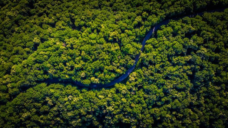
A satellite developed and built in the UK is set to become the first in the world to measure the structure and condition of Earth’s forests in 3D from space.
Known as Biomass, the satellite will use radar technology to map tropical forests over a five-year period, helping scientists understand how carbon is stored and released by forest ecosystems.
Current satellites can only measure the tops of forest canopies. Biomass, using long-wavelength P-band radar, will be able to penetrate cloud cover and foliage to estimate the amount of carbon stored in trees more accurately than any existing satellite.
The data is expected to support climate change research, inform policy decisions, and contribute to long-term net-zero strategies.
The mission was proposed by professors at the University of Sheffield and has been built by Airbus Defence and Space in Stevenage. It will launch from Europe’s spaceport in Kourou, French Guiana, later this month.
Since 2016, UK organisations have secured nearly €91 million in contracts related to the Biomass mission through ESA membership. The mission has involved more than 50 companies across 20 countries, with the UK playing a leading role in design, assembly, and testing.
“The UK is back in the business of climate leadership and protecting the world’s forests through emerging and cutting-edge technologies is crucial to tackling the climate crisis,” said UK Climate Minister Kerry McCarthy.
Also in the news:
Virgin Media O2 to continue 3G switch off in Norwich, Telford, Guildford and Torquay
Amazon reassesses data centre expansion
Investing in the North: How Virgin Media O2 is powering a more connected, inclusive future
Equinix plans to invest £3.9 billion in the project, which will deliver 250+MW of compute
Key takeaways What Is Imagine Lens—and Why It Matters Snapchat’s Imagine Lens lets us create…
Packages downloaded from NPM can fetch dependancies from untrusted sites.
Exclusive Edge, Atlas, Brave among those affected
A critical, currently unpatched bug
The announcement brings Amazon’s total pledged investment in South Korea to $9 billion over the